Our Top Picks
 Humminbird XPLORE 9 GPS Fish Finder with Transducer9-Inch Display11.69 x 3.3 x 6.26 inches4.28 poundsCheck on Amazon
 Humminbird Helix 5 G3 GPS Fish Finder with5-Inch Display15.75 x 4.75 x 9.63 inches2.12 PoundsCheck on Amazon
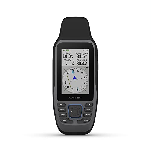

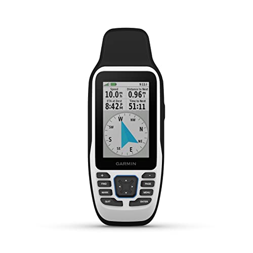

For most boaters, the best marine GPS unit overall is the Garmin GPSMAP 86Sci — a floating, button-operated handheld that ships with BlueChart g3 coastal charts already loaded and adds inReach satellite messaging for areas with no cell coverage. It suits coastal sailors, bay anglers and cruisers who want a navigator that keeps working when the fixed-mount chartplotter at the helm loses power, and whose typical routes stay within a few dozen miles of shore.
Not everyone needs that. On a lake with a tight budget, the Garmin Striker 4 delivers GPS plus CHIRP sonar for the least money in this roundup. If you fish structure and want imaging, the Humminbird XPLORE 9 is the premium answer. If you want a plain, dependable fixed-mount position source that never asks you to buy a chart card, the Furuno GP39 fills that niche better than anything else listed here.
Two entries are not navigators at all, and knowing that up front saves money: the Garmin Drive 53 is a road unit built for a windshield, and the Nautilus LifeLine nexGen is a man-overboard rescue beacon rather than a chartplotter. This guide compares screen size, chart compatibility, sonar features and mounting options so you can match a unit to your vessel, your helm layout and the water you actually run.
Top 3 Picks
Best overall: Garmin GPSMAP 86Sci
It combines the three things that matter most on a small to mid-size boat: preloaded coastal charts so you can navigate immediately, a floating IPX7 body that survives a drop over the side, and inReach satellite messaging so you can still call for help when VHF range runs out. The button layout works with wet or gloved hands, and two AA batteries mean you are never hunting for a charging cable at the ramp. It is the unit to buy if you want one device that covers navigation and emergency communication.
Best budget: Garmin Striker 4 with Transducer
A 3.5-inch display, built-in GPS and CHIRP traditional sonar, plus the transducer in the box. It has no chartplotting, so you navigate by waypoint, track and depth contour rather than by a drawn chart — which is exactly the right trade on a kayak, canoe, dinghy or jon boat where dash space and battery capacity are limited. For the money, nothing else here gets you on the water with depth and position together.
Best premium: Humminbird XPLORE 9
This is the serious fishing and networking platform: a 9-inch HD touchscreen, MEGA Side Imaging+, MEGA Down Imaging+ and Dual Spectrum CHIRP, with Ethernet and NMEA 2000 so it can talk to other displays, autopilots and engine data. It suits a center console or cabin boat where there is a real helm station, a house battery, and enough dash area to mount a screen you read from several feet away. If your fishing depends on reading structure, this is the tier that changes outcomes.
One more worth naming before the table: if your only goal is a rock-solid position fix feeding a radar, AIS or autopilot, the Furuno GP39 is the specialist pick, and it is not a chartplotter at all.
Quick Comparison
Every unit below is a currently listed product. Screen sizes, chart support and sonar types are drawn from published specifications; price tiers are budget, mid-range and premium rather than fixed figures, because listed prices move daily.
| Product | Best for | Screen | Charts & mapping | Sonar | Mounting | Price tier |
|---|---|---|---|---|---|---|
| Garmin GPSMAP 79sc | Coastal handheld backup | 3 in class color, button | Preloaded BlueChart g3 coastal | None | Lanyard, belt clip, RAM cradle | Mid-range |
| Humminbird XPLORE 9 | Imaging sonar plus networking | 9 in HD touchscreen | Humminbird Basemap plus card slot | MEGA Side Imaging+, MEGA Down Imaging+, Dual Spectrum CHIRP | Gimbal or flush, dash | Premium |
| Humminbird Helix 5 G3 | Compact sonar and chart combo | 5 in color, keypad | Basemap plus microSD for LakeMaster/CoastMaster | Dual Spectrum CHIRP, 2D | Gimbal or flush, dash | Premium |
| Garmin eTrex 22x | Land and water basics | 2.2 in color | TopoActive topographic (not marine) | None | Clip, carabiner, RAM | Mid-range |
| Garmin GPSMAP 79s | Worldwide basemap, add your own charts | 3 in class color, button | Worldwide basemap plus microSD | None | Lanyard, belt clip, RAM cradle | Mid-range |
| Garmin STRIKER 5CV | Small-boat fishfinding value | 5 in color | None — waypoint and track navigation only | CHIRP traditional plus ClearVü down scanning | Gimbal or flush, 12 V | Mid-range |
| Garmin GPSMAP 86Sci | Coastal cruising plus satellite messaging | 3 in class color, button | Preloaded BlueChart g3 coastal | None | Lanyard, belt clip, RAM cradle | Premium |
| Garmin Drive 53 | Driving to the water (not a marine unit) | 5 in car display | Road maps only | None | Windshield suction or dash | Budget |
| Furuno GP39 | Fixed-mount position fixing | 4.2 in color | None — numeric navigation display | None | Flush or bracket, 12/24 V | Premium |
| Garmin GPS 73 | Simple handheld backup | 2.6 in | None — basic navigation data | None | Lanyard, clip | Budget |
| Garmin Striker 4 | Kayaks, canoes, dinghies | 3.5 in color | None — waypoint and track navigation only | CHIRP traditional | Gimbal or portable pack | Budget |
| Nautilus LifeLine nexGen | Man-overboard alerting | No chart display | None — position reporting only | None | Lanyard, belt, life vest | Budget |
How We Chose
This roundup is built from published manufacturer specifications, product listings and well-established category conventions rather than any form of physical evaluation. The selection criteria were straightforward. First, category fit: does the unit actually do what a boater needs on the water, whether that is chartplotting, sonar, a fixed position feed or emergency alerting? Second, spec transparency: units made the list when their screen size, chart support, sonar type, power source and mounting method are clearly documented, so a buyer can compare like with like.
Third, use-case coverage. A roundup is only useful if it spans the real spread of buyers, so the list deliberately runs from a 3.5-inch kayak unit to a 9-inch networked sonar platform, and from a road navigator that some people mistakenly take on the water to a dedicated rescue beacon that is not a navigator at all. Fourth, upgrade path: we favored units that fit into a sensible next step — a handheld that becomes a backup once a helm chartplotter arrives, or a fish finder that can later be joined by a second display. Finally, we kept the tiers honest: budget, mid-range and premium reflect the bracket a unit competes in, not a daily price, since those change constantly.
1. Garmin GPSMAP 79sc – Best for Preloaded Coastal Charts in a Handheld
As an Amazon Associate we earn from qualifying purchases at no extra cost to you.
If your boating happens along a coastline — bays, sounds, harbor approaches, a few miles out and back — the GPSMAP 79sc is the handheld that asks the fewest questions of you. It arrives with BlueChart g3 coastal charts already loaded, so you switch it on at the dock and immediately see depth contours, channel markers, buoys and marina entrances without buying a card or learning a chart-management workflow. It suits sailors who keep a handheld in a jacket pocket as a backup to a cockpit plotter, anglers in open boats who want a waterproof navigator they can hand to a passenger, and trailer boaters who run several different coastal regions and would rather not juggle regional chart downloads.
- Display: 3-inch class color screen with button operation, which stays usable with wet or gloved hands
- Charts: preloaded BlueChart g3 coastal charts, no card purchase needed for the covered region
- Body: rugged, floating design with an IPX7 water rating — it survives going over the side
- Power: two AA batteries (alkaline, lithium or NiMH) or an optional rechargeable pack, roughly a full day of typical use per set
- Memory: microSD card slot for additional chart regions, updates or extra storage
- Sensors: 3-axis compass and barometric altimeter for heading and pressure-trend information
- Navigation: waypoints, routes, tracks, man-overboard function, compass page and trip data
- Mounting: lanyard, belt clip, or a RAM-style cradle for a rail, console or dash
The strengths are all about resilience and simplicity. There is no boot sequence waiting on a network, no software subscription, and no dependence on the boat’s electrical system — the single biggest failure point on a small boat is power, and this unit sidesteps it entirely. Drop it in the water and it floats, screen up, which is not a small thing when you are leaning over a gunwale netting a fish. The button interface also means you can operate it one-handed in chop, where a touchscreen becomes frustrating the moment spray and sunscreen are involved.
Chart coverage is the honest limitation. BlueChart g3 coastal charts cover a specific region, so if you trailer from the Gulf Coast to the Pacific Northwest you will eventually want to add a card. For inland lakes, the coastal chart set is not what you need — that is a job for the 79s or a lake-mapping card. Sonar is absent entirely, so if you want depth readings you are looking at a separate fish finder or a unit further down this list.
Pros
- Charts are ready out of the box, so there is no extra purchase before your first trip
- Floats and carries an IPX7 rating — genuinely forgiving of the most common handheld accident
- AA power removes charger dependence and makes multi-day trips simple
- Button controls work reliably with gloves, spray and cold hands
- Small and light enough to live in a jacket pocket or ditch bag
Cons
- No sonar, so it cannot tell you what is under the boat
- Coastal chart coverage is regional; other areas need a card
- The 3-inch class screen is a backup display, not a primary helm display
- No satellite messaging — that feature belongs to the 86 series
Compared with the Garmin GPSMAP 79s: these two share the same rugged, floating body, the same button layout and the same power arrangement. The difference is the chart data. The 79sc includes preloaded BlueChart g3 coastal charts; the 79s ships with a worldwide basemap and expects you to add the chart card you want. If you boat the same stretch of coast every season, the 79sc is the better value because the data is already there. If you cruise internationally, run inland lakes, or simply prefer to choose your own chart regions as you go, the 79s is more flexible and lets you buy coverage only where you need it. Buyers who also want emergency messaging should step up to the GPSMAP 86Sci, which keeps the floating handheld formula and adds satellite communication.
2. Humminbird XPLORE 9 – Best for Premium Imaging Sonar and Networking

The XPLORE 9 is the unit in this roundup built for someone who treats electronics as fishing equipment rather than as a safety accessory. Its 9-inch HD touchscreen, MEGA Side Imaging+, MEGA Down Imaging+ and Dual Spectrum CHIRP sonar make it a serious structure-reading tool, and its Ethernet and NMEA 2000 connectivity means it can sit at the center of a networked helm. It suits center console and cabin boat owners who fish ledges, wrecks, reef and timber, who have a house battery and a real dash, and who want one screen that can show charts, sonar and engine or autopilot data together.
- Display: 9-inch HD touchscreen, large enough to read from several feet away at the helm
- Sonar: MEGA Side Imaging+ and MEGA Down Imaging+ plus Dual Spectrum CHIRP, with a transducer included
- Mapping: built-in Humminbird Basemap with card slots for premium chart cards
- Networking: Ethernet for multiple displays and accessories, plus NMEA 2000 for engine, autopilot and sensor data
- Wireless: Bluetooth and Wi-Fi for phone integration, software updates and waypoint transfer
- Mounting: gimbal bracket for a dash or overhead, or flush mount into a console panel
- Power: 12 V DC from the boat’s electrical system
The core advantage over every other unit here is screen area combined with imaging resolution. Side imaging is the feature that changes how you fish: instead of a narrow cone directly below the transducer, you get a swath to port and starboard that shows the shape of a wreck, the edge of a weed line or a row of pilings as a picture rather than a blip. MEGA-class imaging tightens that picture further, and a 9-inch panel is where those details actually become readable. The touchscreen also makes waypoint marking and menu work dramatically faster than keypad entry, which matters when you are drifting past a productive spot.
Networking is the second advantage and the reason this unit belongs on a boat rather than a kayak. Once an Ethernet backbone exists, a second display can be added at the bow, sonar can be shared, and NMEA 2000 can bring in engine data, fuel flow and autopilot control. That is a platform decision, not an accessory decision, and it is worth planning before you cut any panels.
Pros
- Large 9-inch HD touchscreen that is genuinely readable from the helm seat
- MEGA Side Imaging+ and MEGA Down Imaging+ for detailed structure interpretation
- Dual Spectrum CHIRP gives cleaner traditional sonar returns
- Ethernet and NMEA 2000 support make it a proper networking hub
- Transducer included, so the sonar package is complete at purchase
Cons
- Premium tier pricing and a real installation job — not a clamp-on accessory
- Requires meaningful dash space and a healthy 12 V supply
- Far more capability than a lake kayaker or occasional dinghy user will ever use
- Best chart detail generally comes from separate premium map cards
Compared with the Humminbird Helix 5 G3: both are Humminbird sonar units with Dual Spectrum CHIRP, so the comparison is really about scale and ambition. The Helix 5 G3 gives you a 5-inch keypad-controlled display, 2D CHIRP sonar and a much smaller footprint, which is ideal on a tiller boat, a small center console or a boat with limited panel area. The XPLORE 9 gives you four times the screen area, touch control, imaging sonar and a networking path. If your fishing is depth-and-structure work in a small boat, the Helix 5 G3 covers it. If you want side imaging, multiple displays and data sharing, the XPLORE 9 is the one that will still feel current in five years.
3. Humminbird Helix 5 G3 – Best for a Compact Sonar and Chart Combo

The Helix 5 G3 is the sensible middle path for an angler who wants sonar and GPS mapping on a modest dash without committing to a full electronics refit. Its 5-inch color display, Dual Spectrum CHIRP sonar and internal GPS receiver cover the essentials — depth, bottom composition, fish returns, position, waypoints and speed — in a housing small enough to fit a tiller boat, a skiff or a compact center console. It suits freshwater and inshore anglers who fish the same lakes and bays repeatedly, and who want to mark structure and return to it precisely.
- Display: 5-inch color screen with keypad control rather than touch
- Sonar: Dual Spectrum CHIRP for traditional 2D depth and fish returns, transducer included
- Navigation: internal GPS receiver for waypoints, routes, tracks and speed
- Mapping: built-in basemap with a microSD slot for premium lake and coastal chart cards
- Mounting: gimbal bracket for dash or portable use, or flush mount into a panel
- Power: 12 V DC from the boat’s electrical system
What makes it work is the balance. Dual Spectrum CHIRP produces noticeably cleaner returns than basic single-frequency sonar, separating fish from structure and holding bottom at speed better. The built-in GPS means you are not just seeing depth, you are seeing where that depth is, so a productive hump or brush pile becomes a saved waypoint rather than a remembered landmark. The keypad interface is also an advantage in one specific way: it does not care about wet fingers, spray or sunscreen, which is more than can be said for a touchscreen in an open boat.
The 5-inch screen is the honest constraint. Split between a chart view and a sonar view, each pane gets about half the panel, which is workable at a tiller or a small console but cramped if you sit far from the unit. Mounting it within arm’s reach is not a preference here; it is a requirement.
Pros
- Dual Spectrum CHIRP sonar delivers clean bottom and fish returns
- Internal GPS with waypoints, routes and tracks for repeatable fishing
- Compact 5-inch footprint fits small boats and limited dash areas
- MicroSD slot allows lake or coastal chart cards to be added later
- Keypad control works reliably with wet hands
Cons
- No side or down imaging — traditional 2D sonar only
- 5-inch split-screen views get tight in a two-panel layout
- Requires 12 V power, so it is not a self-contained handheld
- Chart detail depends on buying a card, since only a basemap is built in
Compared with the Garmin STRIKER 5CV: these two compete directly on screen size and price bracket, and the split comes down to mapping. The STRIKER 5CV adds ClearVü down scanning, which gives a photo-like view of what is directly beneath the boat — excellent for picking apart a brush pile or a drop-off. The Helix 5 G3 adds GPS mapping with card support, which is better for navigating unfamiliar water and returning to marked spots. If you fish the same small lake and want the clearest possible picture below the transducer, choose the STRIKER 5CV. If you roam between lakes or run coastal water and need chart context, choose the Helix 5 G3.
4. Garmin eTrex 22x – Best for Land and Water Basics

The eTrex 22x is the unit for boaters whose day starts on a trail or in a truck. It is a compact handheld navigator with topographic mapping, a color display and a rugged, pocketable body, and it suits duck hunters, kayakers, canoeists and shore anglers who want position, tracks and waypoints without paying for marine charts or sonar. It is also a reasonable backup unit for a boater who wants something that works equally well walking a marsh edge at first light and paddling back to the ramp in fog.
- Display: 2.2-inch color screen, compact and readable in daylight
- Maps: preloaded TopoActive topographic mapping for outdoor use
- Memory: 8 GB internal storage plus a microSD card slot for additional map regions
- Power: two AA batteries, with long runtime suitable for multi-day trips
- Body: rugged, IPX7 water-resistant housing that fits in a pocket
- Navigation: waypoints, tracks, routes, compass and trip data
- Mounting: carabiner clip, belt clip or a RAM-style cradle for a handlebar, dash or rail
The eTrex 22x earns its place through versatility rather than specialization. It runs on AA batteries, so it works on a multi-day float without any charging infrastructure. It is small enough to disappear in a jacket pocket, which means it actually comes along rather than staying in a drawer. The color screen and topographic detail are genuinely useful on land, and the track log is a real safety tool when you are navigating back through a marsh or a chain of sloughs in low light.
The catch is that topographic maps are not nautical charts. They show shorelines, roads and terrain, not channel markers, depth contours or no-wake zones. It is also worth noting that the eTrex line is not designed to float, so a tether or float case is a sensible addition on the water. And there is no sonar of any kind — this is a position and mapping device, full stop.
Pros
- Works well on land and water, so one device covers hunting, hiking and paddling
- AA batteries deliver long runtime without charging infrastructure
- Compact, rugged and genuinely pocketable
- Topographic mapping adds real value for shore access and marsh navigation
- MicroSD slot allows extra map regions to be added
Cons
- No marine charts, no depth contours and no channel data
- Does not float, which matters on open water
- No sonar capability
- 2.2-inch screen is small for use while underway
Compared with the Garmin GPS 73: both are compact handhelds in the same price neighborhood, but they are aimed at different users. The GPS 73 is a marine-oriented navigator with a larger 2.6-inch display and sailing-specific tools, and it is built to float — a meaningful difference on open water. The eTrex 22x counters with topographic mapping and more onboard storage, which makes it far more useful once you step off the boat. If your handheld will spend most of its life on the water, the GPS 73 is the safer buy. If it needs to work on the trail, in the truck and on the lake, the eTrex 22x is the more flexible choice.
5. Garmin GPSMAP 79s – Best for Worldwide Basemap Flexibility
The GPSMAP 79s is the same rugged, floating handheld as the 79sc, minus the preloaded coastal charts. It ships with a worldwide basemap and lets you decide which chart regions to add on a microSD card. That makes it the better pick for boaters who run inland lakes, cruise outside the covered coastal regions, travel internationally, or simply prefer to buy chart data only for the areas they actually visit. It suits sailors and anglers who want a durable backup navigator with full freedom over their chart library.
- Display: 3-inch class color screen with button operation
- Maps: worldwide basemap preloaded; regional charts added by microSD card
- Body: rugged, floating design with an IPX7 water rating
- Power: two AA batteries or an optional rechargeable pack, roughly a full day per set
- Sensors: 3-axis compass and barometric altimeter
- Navigation: waypoints, routes, tracks, man-overboard function and trip data
- Mounting: lanyard, belt clip or RAM-style cradle for rail, console or dash
The value proposition here is flexibility. Because the chart data is not baked in, you are not paying for coverage you will never use, and you can build a chart library that matches your actual cruising ground — a lake card for the local reservoir, a coastal card for the summer trip, an international card if you charter abroad. The hardware is otherwise identical to the 79sc: floating, button-operated, AA-powered, and comfortable in a pocket or a ditch bag.
The trade-off is that you have to do a little planning. Buying a chart card means an extra purchase and a little research into which card covers your water. For a boater who runs one stretch of coast all season, that is friction with no benefit — which is exactly why the 79sc exists.
Pros
- Buy only the chart regions you actually boat
- Floats, with an IPX7 rating and a rugged, pocketable body
- AA power keeps it independent of the boat’s electrical system
- Button controls work with gloves and wet hands
- Worldwide basemap makes it usable anywhere out of the box
Cons
- No preloaded coastal charts — an extra purchase is required for detailed navigation
- Chart card costs add up if you boat several regions
- No sonar and no satellite messaging
- 3-inch class screen is a secondary display, not a helm display
Compared with the Garmin GPSMAP 79sc: the two units are hardware twins, so the decision is purely about chart strategy. The 79sc includes preloaded BlueChart g3 coastal charts, which means less research and less spending for a boater who stays in one coastal region. The 79s gives you a blank canvas with a worldwide basemap, which suits lake boaters, international cruisers and anyone who wants to control chart spending region by region. If you are undecided and you boat one coastline, take the 79sc. If your water varies, take the 79s. Either way, buyers who also want emergency satellite messaging should look at the GPSMAP 86Sci instead.
6. Garmin STRIKER 5CV – Best for Small-Boat Fishfinding Value

The STRIK